
Gaston ZIP Code Coverage
The official Gaston County USPS GIS layer is the local source for postal polygons that intersect the county. Its records show ZIP, postal name, state, area, route, and notes. The layer reports postal labels, not individual post-office facilities, so that label is used in the post-office column. The table separates delivery labels from a legal finding about city or county location. Some polygons carry a neighboring-county name because the postal area crosses the county line. Those rows are useful warnings, not proof that every address using the label is in Gaston.
| ZIP | Areas covered in county GIS layer | Post office or postal label | Notes |
|---|---|---|---|
| 28006 | Alexis; Alexis Lincoln Co | Alexis | Shared postal area |
| 28012 | Belmont | Belmont | ZIP and city boundary differ |
| 28016 | Bessemer City | Bessemer City | Postal area |
| 28021 | Cherryville; Cherryville Cleveland Co; Cherryville Lincoln Co | Cherryville | Touches county boundaries |
| 28032 | Cramerton | Cramerton | Postal area |
| 28033 | Crouse; Crouse Lincoln Co | Crouse | Shared postal area |
| 28034 | Dallas | Dallas | Older records may use this seat name |
| 28052 | Gastonia | Gastonia | One of several Gastonia areas |
| 28054 | Gastonia | Gastonia | Postal area |
| 28056 | Gastonia | Gastonia | Multipart or shared shape in GIS |
| 28077 | High Shoals | High Shoals | PO Box Only |
| 28080 | Iron Station; Iron Station Lincoln Co | Iron Station | Shared postal area |
| 28086 | Kings Mountain; Kings Mtn Cleveland Co | Kings Mountain | Shared Gaston/Cleveland area |
| 28092 | Lincolnton | Lincolnton | Verify county and physical address |
| 28098 | Lowell | Lowell | Postal area |
| 28101 | McAdenville | McAdenville | Postal area |
| 28120 | Mount Holly | Mount Holly | Postal area |
| 28150 | Shelby | Shelby | Small county-intersecting polygon |
| 28164 | Stanley; Stanley Lincoln Co | Stanley | Shared postal area |
| 28169 | Waco | Waco | Postal area |
| 29710 | Clover, South Carolina | Clover | Out-of-state layer polygon; verify address |
This table is exhaustive for the inspected county layer. It is not a list of every delivery address in Gaston County, and it is not a substitute for an address-level USPS result.
Gaston Postal Labels and ZIPs
Gastonia has more than one postal area in the county layer: 28052, 28054, and 28056. The last has two GIS polygons or entries, including a shared or multipart shape. A person who knows only “Gastonia” still needs the full street address before using that information for a parcel, city-limit, or election search. Belmont, Bessemer City, Cramerton, Dallas, Lowell, McAdenville, Mount Holly, and other labels work the same way.
Several labels explicitly point beyond Gaston. Alexis, Cherryville, Crouse, Iron Station, Kings Mountain, and Stanley include neighboring-county forms in the layer. Lincolnton, Shelby, and Clover also appear as polygons that touch county geography. A local postal label can therefore be a useful historical or mailing clue without establishing where the situs address lies.
Gaston High Shoals ZIP Note
High Shoals 28077 has a specific limitation in the county USPS GIS description: it is marked “PO Box Only.” The layer also says it was removed from the Lincoln area. A valid postal label does not necessarily provide a street-delivery address, so 28077 should not be used as a shortcut for locating a parcel or person.
That small note is a useful example of why a ZIP lookup needs a second source. A property search starts with a physical or situs address, parcel number, PIN, owner name, deed book/page, or other property field. A post-office-box ZIP identifies a mail route, not a block or a county tax parcel.
Note: Treat a PO Box ZIP as mailing information until a separate official address or parcel record confirms the physical location.
Gaston USPS ZIP Layer
County metadata says the USPS polygons were provided by USPS and digitized by Land Records using street, roadway, parcel, and related data. The feature layer was updated November 13, 2024. That date identifies the map layer reviewed, not a promise that a delivery rule or individual address has remained unchanged.
The GIS service is especially helpful when a postal label appears to cross a boundary. Its fields can be compared with the Gaston County PublicGIS Map, where parcel and local-government layers supply the other side of the question.
The official USPS layer shows the county's mapped postal geography.
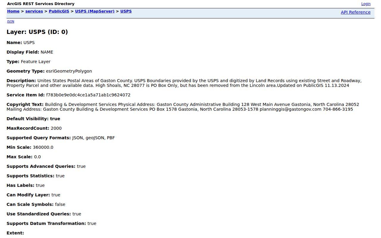
The image is best read as a map of postal areas touching Gaston County, with address verification still required for a specific location.
Search a Gaston Postal Area
There is no official portal offering a ZIP-wide roster of Gaston residents. ZIP information is an organizing and verification tool, not a public person-search filter. The county GIS result can show a ZIP for a parcel, while the voter lookup is name, birth-year, and county based. The Register of Deeds index is organized around parties, dates, books, pages, and document types. eCourts uses case and location fields instead of a postal-area roster.
- Enter the full address in the USPS ZIP Code Lookup to confirm the delivery ZIP and postal city.
- Search the same physical address in Gaston GIS Search and record the parcel number or PIN if a result appears.
- Open the parcel detail and compare its physical address, postal ZIP, city limits, ETJ, deed reference, and owner field without treating any one value as a household list.
- Use the relevant custodian only after the question is narrowed, such as the Register of Deeds for a recorded instrument or Elections for a lawful voter-record request.
Once a verified ZIP narrows the search to a particular road, the Gaston street directory has the address-by-address workflow. Postal geography should not replace a street or parcel check.
Gaston GIS Fields and Postal Areas
Gaston GIS is ZIP-capable because the parcel details include postal state and ZIP, not because the search form supplies a public ZIP-wide people filter. Start with an address, parcel number, PIN, owner name, deed book/page, or plat book/page. The returned parcel can then be compared with the mapped delivery label. This distinction keeps a postal search from becoming an unsupported conclusion about who is at an address.
| Gaston GIS field | Input or result | Use with a ZIP question | Limit |
|---|---|---|---|
| Primary Property Address | Search input | Find the parcel tied to a full street address | Address spelling and old names may vary |
| Parcel # or PIN | Search input | Carry a verified parcel between GIS and tax records | Identifies property, not every person there |
| Owner Name | Search input | Find an assessed-owner record for a known name | Owner field is not a resident roster |
| Postal address and ZIP | Property-detail result | Compare the parcel's postal label with USPS | Mailing and physical addresses can differ |
| City limits and ETJ | Property-detail result | Check municipal context beside the ZIP | Map is tax/reference data, not a legal survey |
The parcel viewer also exposes legal description, neighborhood, deed and plat references, districts, and other tax-reference fields. Use a deed, plat, or survey when a legal boundary question matters.
Note: A parcel result supplies tax-reference fields, but it does not establish every person connected with that street address.
Gaston ZIP Code Boundaries and City Limits
A ZIP boundary is not a city limit, census tract, school district, or county line. The parcel's physical or situs address identifies where land is located. A postal city and ZIP identify delivery routing. A tax mailing address tells the county where correspondence goes. A deed legal description identifies the tract in legal terms and may persist when a street name changes. Each answers a different question.
- ZIP and ZIP+4
- A ZIP is a postal area. ZIP+4 adds a smaller delivery segment and does not establish a municipal or parcel boundary.
- PO Box ZIP
- A ZIP used for post-office-box mail, such as the county layer's High Shoals 28077 note, rather than proof of street delivery.
- Postal city
- The city name used for mailing purposes. It can differ from the parcel's municipality or county location.
- Carrier route
- A USPS delivery grouping. It is a mail-service concept, not a public list of people or a local-government district.
Gaston also has city-limits and ETJ fields in the parcel detail. Compare them with the postal data instead of assuming that a Gastonia, Kings Mountain, or Cherryville mailing label resolves the jurisdiction.
Verify a Gaston ZIP Code Address
Use two official sources for a specific address. USPS confirms the delivery ZIP and postal city. County GIS confirms whether a mapped property record exists and provides the tax-reference fields attached to it. If a street is near a county edge, compare the USPS output, parcel county, physical address, and city-limits field before contacting an office. A ZIP label alone cannot choose the correct custodian.
A persistent mismatch should be documented rather than forced into one label. Older directories may use a mill village, a route, Dallas as the former county seat, or another historic place name. The county converted paper tax maps to GIS in 2002, so older property references may use a different parcel format. Deed, plat, library, and office records can supply the bridge when the current address does not.
Gaston ZIP Code Directory Limits
A postal map cannot reveal a complete set of people at an address, household membership, utility customers, or protected locations. North Carolina voter records have confidential fields, and qualifying protected-voter and Address Confidentiality Program addresses may be withheld. A parcel owner and a tax mailing address are separate fields with their own limits. Use records for a lawful, specific question and stop when the answer is reached.
North Carolina Public Records Law, Chapter 132, allows inspection and copies of existing public records subject to record-specific confidentiality rules. It does not require a county or city to create a new ZIP-based people compilation. If an office has no such list, an address-by-address request to the correct custodian is more accurate than attempting to assemble one from unrelated sources.
Note: Postal information can verify a place, but it cannot turn an official map into a complete directory of current households.