
Work a Gaston Street Directory
A useful street-by-street search starts with one physical address, not a surname. In Gaston, the county property tools turn that address into a parcel number, PIN, current assessed owner, mailing address, deed book and page, plat reference, legal description, ZIP, and city-limits or ETJ flag. Those are different kinds of evidence. A physical address, also called a situs address, identifies the parcel. A tax mailing address tells the Tax Office where correspondence goes. Neither alone proves that a particular person currently lives there. The strongest result preserves the source and date beside each fact.
- Enter the address in Gaston GIS Search and save the parcel number or PIN, deed book/page, plat book/page, and legal description.
- Open the same area in the Gaston County PublicGIS Map. Use Identify Features and parcel labels to compare adjoining lots without assuming they share an owner.
- Use the deed book/page as a lead in the Register of Deeds real-property index, then read the recorded instrument and its prior reference.
- For a name already supported by the records, use the North Carolina Voter Search as a name-first confirmation tool. It is not a browseable street roster.
- For an earlier household, use the library's street and householder sections in the directory run that covers that place and year.
That order keeps each record in its lane. GIS supplies the parcel key, the recorder supplies the instrument, election data has protected fields, and historical directories provide dated household clues. Note: A result from a street search should identify the record behind a name rather than merge current and historical entries into one claim.
Gaston Street Directory Parcel Keys
Gaston address research becomes more precise when the search shifts from spelling alone to the identifiers in the tax map. GIS accepts a primary property address, owner name, parcel number, PIN, deed book/page, and plat book/page. It also exposes filters for property use, neighborhood name, township or district code, year built, acreage, sales year or amount, and physical characteristics. The dynamic dropdown choices can change, so a live search should be read from the county control rather than copied from an old screenshot.
The Gaston GIS Search screen shows the address and record fields that make that handoff possible.
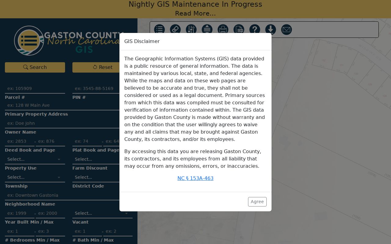
Use one identifier at a time when an address has changed form, then compare the returned deed and plat references with the map detail panel.
| GIS field | Street-search use | Careful reading |
|---|---|---|
| Primary Property Address | Finds the parcel at its physical location. | Try a former spelling or historic label when the current street fails. |
| Parcel # or PIN | Links GIS and tax records after an ambiguous address search. | A parcel can split or merge, so keep the search date. |
| Deed Book and Page | Bridges to the recorded instrument. | Read the deed rather than treating the field as title proof. |
| Plat Book and Page | Locates the subdivision or lot map. | Compare it with the legal description when an address changed. |
| Neighborhood Name | Groups tax-map records in a local area. | It is an assessor label, not proof of a civic association. |
Browse Gaston Streets in GIS
The map is the best tool for seeing a street segment as parcels. Turn on parcels and labels, select Identify Features, and click the polygons along the road. Its layers include imagery, county boundaries, zoning, natural resources, elections, public safety, and labels. Measurement, drawing, layer-swipe, print, and buffer controls help distinguish a short road section from a whole neighborhood. A buffer can return parcels near a point, but that is a land set, not a list of every person nearby.
The PublicGIS Map provides the adjacent-parcel and property-detail controls used for this portion of a Gaston address search.
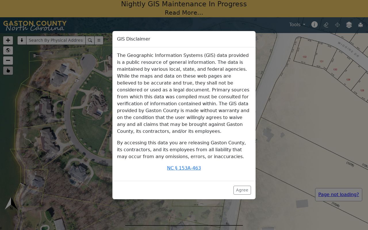
The resulting parcel table can display parcel, owner, mailing and physical address, deed and plat references, sale, acreage, use, and value, with a CSV control. Keep any exported row tied to its search date.
Read Gaston Street Property Detail
Gaston GIS Property Details separates mailing and physical addresses and adds the current owner, township, deed book/page, sales information, plat reference, legal description, property use, year built, acreage, value fields, city limits, ETJ, police and fire districts, watershed, flood area, and census tract. This makes the detail panel useful for checking which government geography applies to the parcel. It is not a legal survey, and its tax data is not a title opinion.
- Current owner: an assessed ownership field, which can name an organization, estate, trustee, or individual.
- Mailing address: a place for tax correspondence that may be outside Gaston County.
- Legal description: the lot, block, subdivision, tract, or boundary language used to keep the right land in view.
- City limits and ETJ: flags that help determine whether municipal and county records may be involved.
Where a mailing city differs from the street address, do not treat that difference as an error. It may reflect a PO Box, a business office, a trustee, or another correspondence arrangement.
Follow Gaston Street Deed References
After GIS supplies a book and page, use the Register of Deeds index as the next link. The Standard tab has Last and Given name fields, Grantor, Grantee, or Either party controls, a From Date and To Date, plus Search and Reset. The Advanced tab adds last or firm name, first name, document number, document type, book, page, book/page reference, conveyance or tax date ranges, and similar-name or Soundex choices. Start with exact spelling, then use variants only when the exact search fails.
The Gaston deed-index Standard search is the recorded-instrument entry point.
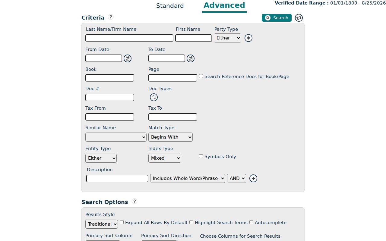
A hit is a lead to the image, book/page, or document number. Read the document type and legal description before deciding that the parties transferred ownership. A deed of trust or lien does not by itself show a purchase.
- Parcel
- A tax-map unit of land. It is an identifier, not a statement about everyone at the address.
- Situs address
- The physical location of the parcel, as distinct from the mailing address used for tax correspondence.
- Plat
- A recorded map that can identify lots, blocks, and subdivision lines when street names are unreliable.
- Criss-cross directory
- A historical directory section arranged by street and number, useful for a dated address lookup.
Gaston Street Names and Villages
Historic address searching needs the label used at the time. Gaston Library's directory guide lists mill-village and neighborhood entries including Arlington Heights, Armstrong Park, Flint, Gray, Groves, Love Heights, Osceola, Parkdale, Piedmont Spinning, Ruby, Seminole, Winget, Arkray, Mutual, Myrtle, and Victory. A literal modern street search can miss a household filed under a village, nearby town, route, or abbreviated street name.
The guide gives a specific 1940 warning: Arkray Mills Village numbers should also be checked under Arkray, Bond, and Brown. No verified countywide renumbering year was found. Work backward with the historic street or village label, record the exact directory year, and use the legal description or plat to test whether two address forms describe the same parcel. Note: An early directory may be town or mill centered, not countywide.
Gaston Street Records Coverage
No one record provides a complete street directory. Address-keyed records are strongest when their limits are stated alongside their useful fields. The coverage below keeps the current parcel layer, recorded land trail, historical street listings, and election information separate.
| Address record | Custodian | Street evidence | Access path |
|---|---|---|---|
| Property and GIS record | Gaston Tax Mapping/GIS | Parcel, assessed owner, physical and mailing addresses, deed/plat pointers, city and district fields. | Free GIS Search and map. |
| Recorded land instrument | Gaston County Register of Deeds | Parties, recording data, instrument type, legal description, and prior references. | Online index and images where available; office help for older material. |
| Historic street section | Gaston County Public Library | Dated householder and address listings in selected directory runs. | Library microfilm, licensed databases, and digitized material where available. |
| Voter registration record | North Carolina State Board of Elections / Gaston Elections | Name-first registration information subject to protected fields and addresses. | Individual state lookup or a lawful county-list request. |
| Permit or code file | Relevant city or county jurisdiction | Address, permit number, date, and an applicant, contractor, or owner where a live system permits. | Confirm jurisdiction and request an existing record by address or permit number. |
For a current address, begin with GIS. For an older household, start with the closest matching directory year. For a land transfer, the recorded deed is the deciding source.
Gaston Street Voter Evidence
The state voter lookup requires first name, last name, county, and at least one voter-status choice, with year of birth available to narrow a match. That design matters: it is a name-first lookup, not a street browser. A county voter list may be requested on electronic or magnetic media and may include residential or mailing address and precinct, but the Board charges actual preparation cost and must withhold protected fields and protected addresses.
Permit and code files can supplement a date or construction question, but they also need careful reading. An applicant, contractor, or owner named in a file is not automatically a current occupant. Search the live system by address or permit number when available, and first confirm whether the parcel lies in city or county jurisdiction.
Gaston Street Counter Fallbacks
Gaston moved land-record searching to a new vendor on May 28, 2026. The county says old-system records are available through the new public search system, while also warning that some older material is not online. The online index itself is not the official record and can show temporary entries. Save the instrument number, book/page, and access date before requesting a copy or checking the physical series.
When a book, image, or older index does not appear online, contact the Register of Deeds Land/Real Estate Records office at 704-862-7681. Give the address, parties if known, instrument type, approximate date, and book/page or parcel clues. The county property-records page is the current vendor and access notice. For the older historical chain, the library house-history resources, FamilySearch microfilm, and the North Carolina State Archives Gaston guide are documented alternatives.
Gaston Street Search Limits
A public street record cannot produce a complete household list. It does not reveal every person at an address, visitors, delivery recipients, utility customers, or a current DMV address. Driver information is protected by the federal Driver's Privacy Protection Act. Utility customer personal information has statutory limits. Voter addresses can be protected for qualifying protective-order or Address Confidentiality Program participants. A missing name can reflect a protected field, a historical gap, a move, or a record that was never designed as a resident list.
Lawful use. Use Gaston address records for personal research, family history, property questions, and civic context. Do not use public records to stalk, harass, intimidate, or expose a protected person.
Gaston Street Record Gaps
For land questions before Gaston County formed from Lincoln County in 1846, move to Lincoln County records or State Archives land-grant sources rather than assuming a missing Gaston deed settles the question. Series begin at different times: the library guide identifies grantor and grantee indexes from 1846, recorded deeds from 1847, state grants from 1845 to 1891, and plat books from 1913 to 1964. Gastonia became the county seat in 1911 after Dallas, another reason old references may use a different place name.
The documented 1874 courthouse fire is a reason to ask an archival question, not to infer a missing transaction. The official research found repair accounts but no exact list of destroyed or recreated series. Compare surviving index, deed-book, library microfilm, and Archives references, then write down the gap rather than silently filling it with a guess.